The Remote Sensing for Digital Earth (RSDE) is a research unit in the Center for Digital Society (DigiS) at Fondazione Bruno Kessler (FBK).
RSDE was established on July 1st, 2013, since then the group is actively conducting research in the remote sensing field. The unit includes junior scientists pursuing their PhD, and senior scientists, it is actively supervising undergraduate students for their Bachelor’s and Master’s thesis. RSDE members are involved in several funded projects of local/national up to European and international relevance. RSDE contributes to the research community with many journal papers accepted every year and participation into key conferences and symposia in the remote sensing and related fields.
RSDE develops advanced systems, end-to-end chains, and methods for satellite and airborne remotely sensed image processing. Our members’ research interests are in pattern recognition, machine learning and deep learning methodologies, in domain adaptation and transfer learning. We develop and exploit in real-world applicative contexts supervised, semi/partially-supervised and unsupervised learning architectures. We have long-term experience and knowledge of time series analysis, change detection, semantic segmentation, parameter estimation, we work with multispectral, hyperspectral images and radar/radar sounder data with low-to-high spatial and temporal resolutions[1], and when possible we integrate publicly accessible geographic information system (GIS) data to our processing.
Active research in these fields requires synergistic use/exploitation of cutting-edge technologies, know-how and well-grounded methodologies to accomplish the needs of modern-days real-world. RSDE is actively involved in both Earth Observation and Space Exploration, at different levels of concept:
|
Earth Observation topics |
Space Exploration topics |
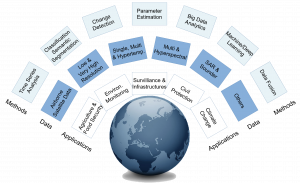
RSDE actively contributes to the objectives of the FBK mission by pushing forward the advancement of knowledge in the remote sensing field, which in turn has great impact on both local and global communities of people. From an high-level perspective, the backbone of RSDE activity can be contextualized along four main directions:
Environmental Monitoring and Climate Change
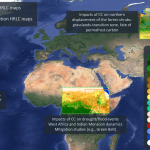
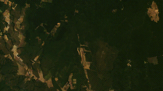
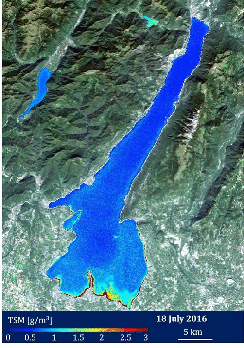
Remote sensing technology provides the opportunity to acquire information about Earth regularly since the 70ies. Several variables can be estimated from remote sensing data that provide hints on Earth evolution and the cause/effects of climate change phenomena. Towards this aim, RSDE works for example on land use and land cover classification, time-series analysis for change detection, abrupt change detection associated to natural disasters (like forest fires and floods), study of the cryosphere (ice caps layering), water quality estimation, etc.
|
Land cover classification and change detection in time-series of Sentinel-2 images from the ESA CCI High Resolution Land Cover (HRLC) project, particular in Amazonia with forest replaced by cultivations |
|
|
|
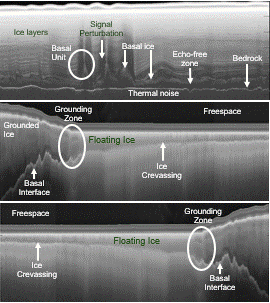
Segmentation maps of ice subsurface from radar sounder data acquired near the coastal areas of Antarctica |
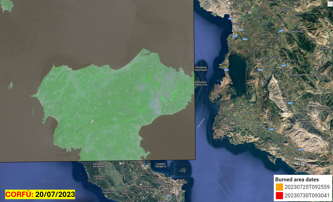
Burned area detection and tracking from Sentinel-2 images in two hot spots of the Mediterranean sea, Corfù and Rhodes islands heavily hit by wildfires during summer 2023 |
|
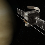
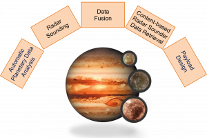
Planetary exploration
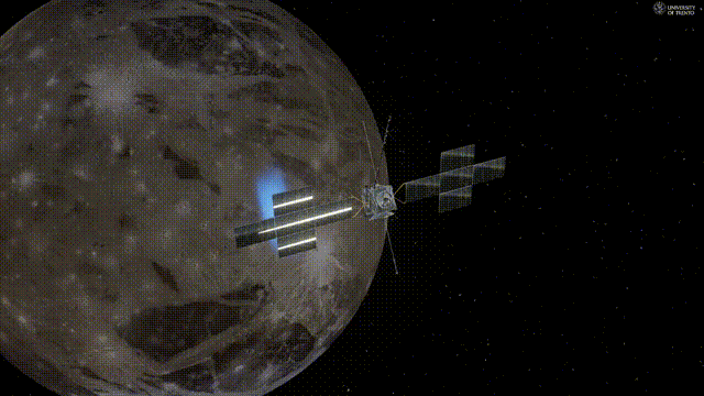
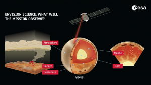
Improving the knowledge about other planets is a way to learn more about Earth and its future. RSDE is involved in the design of radar sounder systems and the analysis of data from planetary exploration missions. RSDE is involved in the Radar for Icy Moon Exploration (RIME) on ESA Jupiter for Icy Moon Exploere (JUICE) mission targeting the Jupiter system and its icy moons (as a small Solar system), and the Subsurface Radar Sounder (SRS) on board ESA EnVision targeting Venus (as an Earth twin).
|
Rendering of the radar-sounder RIME scanning the surface of Ganymede (a Jupiter’s moon) in the JUICE mission, that will reach the Jovian system in 2035 |
Concept of EnVision mission, the first investigating Venus from its inner core to its upper atmosphere, characterising the interaction between its different envelopes |
Human Infrastructures, Management and Planning
The role of remote sensing in monitoring human infrastructures and managing natural resources is prominent, if not essential. RSDE is deeply involved in the study, implementation and deployment of remote sensing image analysis techniques within different application contexts such as: precision agriculture, forest inventoring, infrastructure monitoring, disaster assessment, civil protection, etc.
|
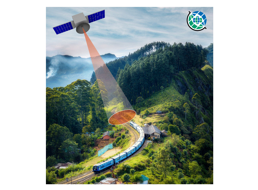
Instantaneous Infrasctructure Monitoring by Earth Observation (IIMEO) mission concept applied to railway infrastructure SAR-based obstacle detection |
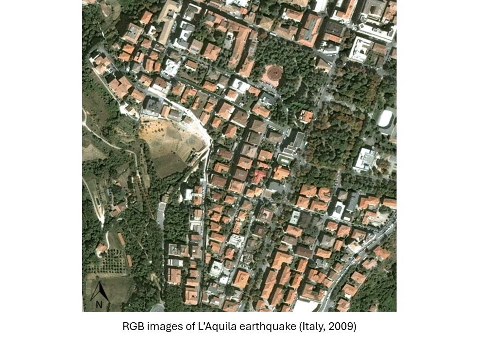
Building change detection on SAR bi-temporal images, example of collapsed building detection after earthquake event in the city of L’Aquila (Italy, 2009) |
|
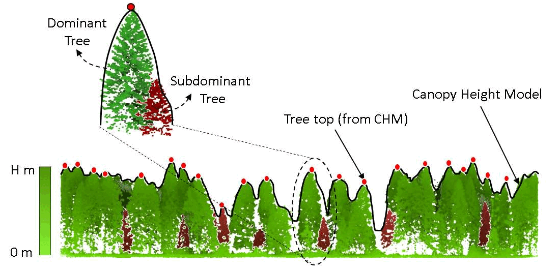
Tree canopy segmentation and detection of sub-dominant trees using Lidar point clouds for forestry inventory |
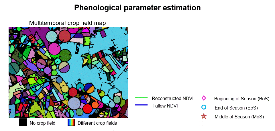
Crop phenological parameter estimation for precision agricolture application using Sentinel-2 images |
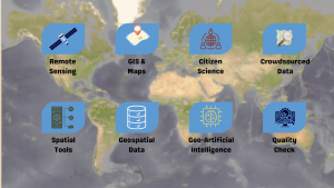
Open and crowdsourced data
RSDE, together with DCL, develops methodologies taking advantage of both remote sensing data and crowdsourced information (e.g., OpenStreetMap data) to improve processes like semantic segmentation, change detection and updating of map information, assessment of disaster impact.
|
Synergy of remote sensing with open data and geo-spatial tools and services |
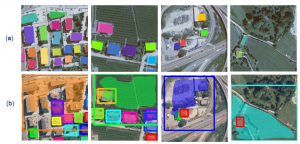
Remote sensing based pre-processing of OSM image annotations to improve the performance of semantic segmentation. Results with: (a) quality-improved OSM data, and, (b) noisy OSM data |
[1] Interested in a friendly introduction to Remote Sensing? This tutorial by NASA nicely presents the basic concepts of satellite-borne remote sensing technologies: orbit types, sensor characteristics, image resolutions and the basics to data analysis and processing.